Don’t get lost at sea! Learn the basics of navigation for sailboats in the United States!
Basic navigation guide for sailors. Navigating a sailboat is one of the most fundamental and essential skills that a sailor should possess. It involves using tools, maps, and intuition to determine the boat’s position, direction, and destination.
For new sailors, navigating a sailboat can be intimidating and challenging, but with the right knowledge and preparation, it can be a fulfilling and rewarding experience.
In this guide, we’ll take a look at the basics of navigation for sailboats in the United States, covering essential skills, tools, and resources.
Understanding basic Navigation Tools
The first step in learning how to navigate a sailboat is understanding the tools you’ll be using. Some of the most common navigation tools include:
The first step in learning how to navigate a sailboat is understanding the tools you’ll be using. Some of the most common navigation tools include:
Basic navigation tool #1: Compass
(Compass: A compass is a navigational instrument that shows the direction of the boat relative to magnetic north.)
Having a compass with large numbers and lights up at night can be extremely beneficial for navigation, especially in low light or dark conditions.
The large numbers make it easier to read and interpret, while the illumination ensures that it can be read even in complete darkness. This can be particularly helpful for night sailing or when navigating through channels or areas with limited lighting.
Additionally, a compass with these features can also provide a sense of security and confidence in knowing that you have a reliable and accurate tool to guide you on your journey.
Basic navigation tool #2: Charts
(Charts: Charts are maps that provide information about the water, including depths, currents, and potential hazards.)
Online charts have become increasingly popular among sailors, as they offer many benefits over traditional paper charts.
One major advantage is that online charts are frequently updated with the latest navigational information, including new hazards, changes to channel markers, and other important information that can affect your voyage.
Online charts are also more interactive and user-friendly than traditional paper charts, allowing you to zoom in and out, add location markers, and view the chart from different angles.
One of the most popular chart apps is Navionics, which offers a comprehensive set of charts for both inland and sea navigation. Navionics charts are continuously updated with the latest information and are available for a small fee.
In addition to providing detailed navigational information, Navionics also includes useful features like a tides and currents planner, route planning tools, and a fishing mode that shows you where to find the best fishing spots.
Despite the many advantages of online charts and chart apps, many sailors still prefer traditional paper charts. Paper charts offer a tactile and physical experience that cannot be replicated with digital charts, and many sailors feel more comfortable relying on paper charts as a backup in case their electronic devices fail.
Additionally, paper charts are required by law for certain types of navigation, such as offshore racing and commercial shipping.
Basic navigation tool #3: GPS
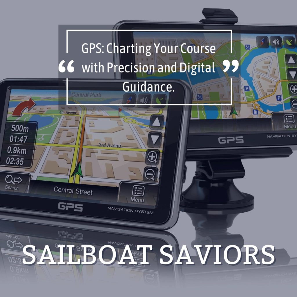
(GPS: GPS (Global Positioning System) is a satellite-based navigation system that provides accurate location information.)
When it comes to GPS, there are many options available for sailors of all levels and budgets. Those just starting out or with limited funds can utilize the GPS on their phones or tablets, even older models that have the capability to make phone calls can access the GPS without having a cellphone service plan.
However, it’s important to watch out for potential issues when sailing to a new country where your device may not be recognized. For example, when sailing to Mexico, our iPhone and iPad did not work, but an Android GPS w still functioned.
One great option for sailors is to use chart apps like Navionics, which provides charts that can be used inland or at sea for a small fee. These charts use GPS to track location and provide valuable information about navigation hazards like new sandbars, sunken boats, and bridge repairs.
Additionally, online charts are helpful as they allow users to update content in real-time, such as adding new hazards or making changes to the location of markers.
Moreover, it’s important to remember the benefits of paper charts as a backup in case technology fails. Even older paper charts are better than none!
(Not-so) Basic navigation tool #4: Sextant
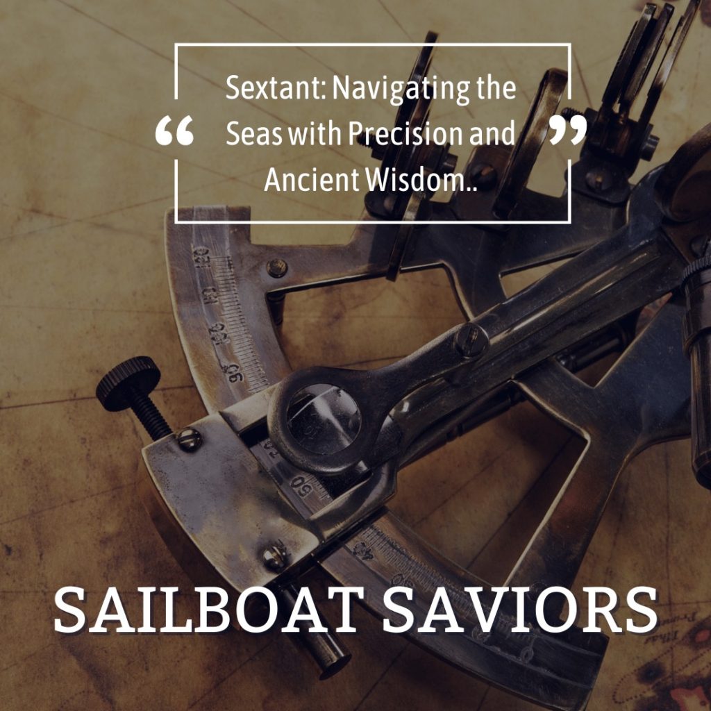
Sextant: A sextant is a navigational instrument used to determine the angle between two objects, such as the horizon and a celestial body.
A sextant is typically used in situations where traditional navigational aids, such as GPS, are not available or have failed. It is commonly used by sailors and other navigators to determine their position and to navigate the open seas.
A sextant is a tool used to measure the angle between two visible objects, such as the horizon and the sun, moon, or stars. It consists of an arc of 60 degrees, which is marked in minutes and seconds, and a movable index arm that can be adjusted to measure angles. The index arm also includes a small telescope, which allows the navigator to align the instrument with the objects being measured.
The sextant was invented in the 18th century by John Hadley and Thomas Godfrey, who independently developed the instrument in England and America, respectively. The sextant quickly became the preferred navigational tool for sailors, as it allowed them to determine their position with much greater accuracy than was possible with earlier instruments, such as the quadrant and octant. Over time, the sextant has been improved and refined, but it remains an essential tool for navigators who travel the open seas. Please keep in mind, if you are a sailor on a budget, not having a sextant on board does not mean your travels can’t begin.
Plotting Your Course Over water
You’ve found the right boat. Now what? Once you’ve familiarized yourself with the basic navigation tools, the next step is to plot your course. Here are the general steps to follow:
-
- Determine your starting point and destination.
- Consult the chart to determine the best route.
- Use your compass to set the boat’s direction.
- Use your sextant to determine your latitude and longitude.
- Check your GPS to ensure accuracy and make any necessary adjustments.
Determine your starting point and destination
The first step is to determine your starting point and destination. This will help you to figure out the distance you need to cover, and the direction you need to go in.
Consult the chart to determine the best route
Once you know your starting point and destination, you can consult the chart to determine the best route. You need to take into consideration factors like tides, currents, wind direction, and any potential hazards along the way.
Use your compass to set the boat’s direction
Once you’ve determined your route, you need to set your boat’s direction using your compass. This will help you to stay on course and make any necessary adjustments along the way.
Use your sextant to determine your latitude and longitude
As you sail along your route, you can use your sextant to determine your latitude and longitude. This will help you to keep track of your position and make sure that you’re on the right track. Again, we have been sailing for years and still do not have a sextant on our boat. You can start sailing without one!
Check your GPS to ensure accuracy and make any necessary adjustments
Along with using your sextant, you can also use your GPS to ensure accuracy and make any necessary adjustments. This is particularly important if you’re sailing in an area with lots of hazards or difficult conditions.
Basic NAVIGATION REQUIRES Attention to Details
Overall, plotting your course involves careful planning and attention to detail. By taking into consideration factors like tides, currents, wind direction, and potential hazards along the way, you can make sure that your journey is safe and successful.
Remember to always carve out a weather window first, and plan and plot out safe harbor anchoring locations in advance, check bridge opening times, gather phone numbers for bridge tenders just in case your radio fails, and check hours of operations for locks. Also, make sure the time of arrival at a new destination is timed for safe navigation.
Considerations When Navigating
Navigating a sailboat isn’t just about using tools and plotting a course. There are other considerations to keep in mind, such as:
Tides & currents:
Tides and currents can have a significant impact on your boat’s speed and direction. We’ve had current so strong on several occasions that our boat moved backwards and lost the distance we covered. The only option was to anchor and wait for the current to slow.
Weather conditions:
The weather can change quickly at sea, so it’s essential to stay updated on the forecast and plan for safe places to stop or tuck in case the weather changes suddenly for the worse.
Navigation aids:
Navigation aids, such as buoys and lighthouses, can be a useful tool for staying on course.
Lighthouses
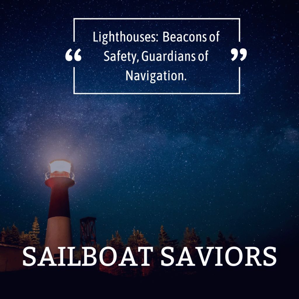
Lighthouses are an essential tool for mariners, especially when sailing at night or in poor visibility conditions. One of the key features of a lighthouse is its light, which helps sailors identify their position and navigate through treacherous waters. Lighthouses emit light in a specific pattern, which can be used by sailors to identify them from other sources of light, like ships or buoys.
The pattern of a lighthouse’s light is unique and can be used to distinguish it from other lights. The light pattern of a lighthouse is called its characteristic, and it is defined by the number, duration, and color of the flashes, as well as the intervals between them. The characteristic of each lighthouse is different, so it is important for sailors to familiarize themselves with the light patterns of the lighthouses along their route.
For example, some lighthouses emit a steady light, while others have a flashing pattern. A lighthouse with a flashing pattern might have a group of flashes, followed by a period of darkness, and then another group of flashes. This pattern helps sailors identify the lighthouse from other sources of light and also indicates the location of the lighthouse.
It is also important to note that the color of a lighthouse’s light can also be used to identify its location. In the United States, for example, red lights are used to mark the port side of a channel, while green lights are used to mark the starboard side. Lighthouses may also use other colors, such as white or yellow, to indicate different things, like warning of shoals or marking safe entry points.
Overall, understanding the light patterns of lighthouses is crucial for safe navigation at sea, especially at night or in poor visibility conditions. By familiarizing themselves with the characteristics of each lighthouse along their route, sailors can ensure that they stay on course and avoid any potential hazards.
Buoyage & markers
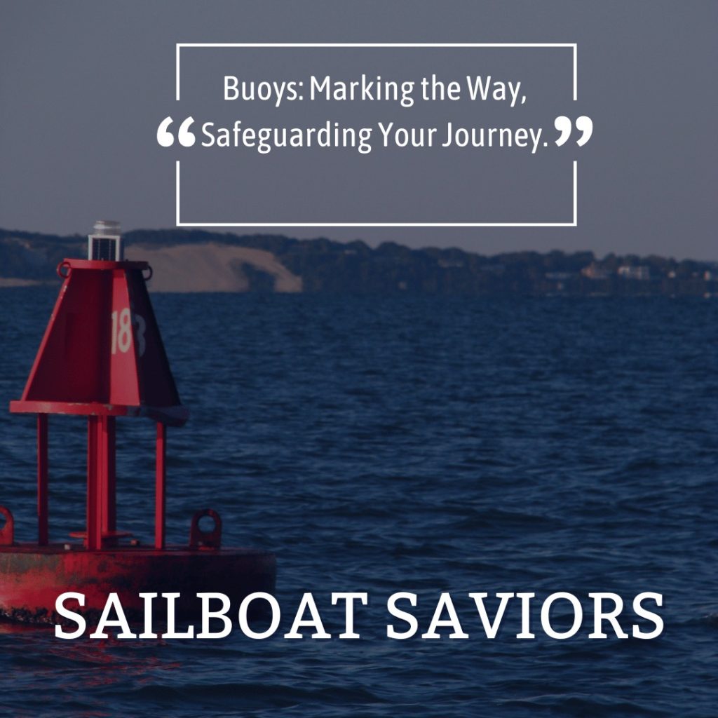
Buoyage and markers are essential navigational aids for boaters, especially when sailing in unfamiliar waters. In the United States, the U.S. Coast Guard manages the navigation aids, including buoys and markers, and establishes rules for their use.
Buoys are floating markers that are anchored in the water and used to mark channels, hazards, or navigational points. There are two types of buoys: lateral and non-lateral. Lateral buoys are used to mark the edges of a channel. They are either red or green, and their colors indicate on which side of the channel they should be passed. Red buoys must be kept on the right (starboard) side when entering a channel, while green buoys must be kept on the left (port) side. Non-lateral buoys are used to mark areas such as shoals, obstructions, or special navigational areas. These buoys are either yellow or white, and their purpose is indicated by their shape and markings.
Markers are similar to buoys but are usually attached to a stationary structure such as a piling or a shore. They are used to indicate specific areas, such as no-wake zones, speed limits, or navigational hazards. Markers are also used to indicate the location of marinas, boat ramps, and other facilities.
It’s important for boaters to understand the different types of buoys and markers and their meanings to ensure safe navigation. Boaters should consult nautical charts and follow the U.S. Coast Guard’s navigation rules to avoid hazards and stay on course.
Other Boats
- It’s important to be aware of other boats in the area to avoid collisions.
Right of way rules are essential for safe boating, and every boater must understand and follow them. These rules specify who has the right of way in different situations when two vessels meet on the water. In the United States, the basic rules for right of way include:
Powerboats vs. Sailboats:
Sailboats generally have the right of way over powerboats. However, in some situations, such as when the sailboat is overtaking the powerboat or when the powerboat is constrained by its draft, the powerboat has the right of way.
Head-on Situation:
When two vessels are approaching each other head-on, both must alter their course to starboard (right). This means that both vessels should pass each other on their port (left) side.
Crossing Situation:
When two vessels are crossing each other’s paths, the boat on the right has the right of way. This means that the boat on the left must yield and alter its course to avoid a collision.
OVERTAKING:
When one vessel is overtaking another vessel, the overtaking vessel must keep clear of the vessel being overtaken.
Restricted Visibility:
When visibility is restricted due to fog, heavy rain, or other conditions, the rules for right of way change. In this situation, boats must use their sound signals to communicate their position and intentions.
A Friendly, but Critical ReminDer!!!
Understanding and following these basic right of way rules is crucial for safe boating. It’s also essential to keep a safe speed and stay alert at all times to avoid collisions and ensure the safety of everyone onboard.
Basic Resources for Navigation
There are many resources available to help you navigate a sailboat, including:
NOAA charts:
The National Oceanic and Atmospheric Administration provides free charts for US waters.
Navigation apps:
Navigation apps, such as Navionics and iNavX, can provide GPS navigation and chartplotting on your smartphone or tablet.
US Coast Guard:
The US Coast Guard provides safety information, including navigational rules and regulations.
Conclusion:
Basic navigation is an essential skill for any sailor, and with the right knowledge and preparation, it can be a rewarding and fulfilling experience. By understanding the tools, plotting your course, and considering important factors, you can navigate your way to success. Remember to always stay informed and up-to-date on safety regulations and guidelines.
Bonus content:
Here are some sailboat communities and forums where sailing enthusiasts gather to discuss, share knowledge, and engage in conversations related to sailboats:
- Cruisers Forum (www.cruisersforum.com)
- Sailing Anarchy (www.sailinganarchy.com)
- SailNet (www.sailnet.com)
- Sailing Forums (www.sailingforums.com)
- YachtForums (www.yachtforums.com)
- Sailboat Owners (www.sailboatowners.com)
These communities and forums provide a platform for sailors of all experience levels to connect, seek advice, share stories, and discuss various topics related to sailboats. Engaging with these communities can help you expand your network, learn from experienced sailors, and gain insights into the sailing community.